 I-24 Southeast Choice Lanes
I-24 Southeast Choice Lanes
I-24 Southeast Choice Lanes
An interactive overview of the proposed I-24 Southeast Choice Lanes corridor, providing stakeholders with a clear, navigable view of the alignment, major interchanges, user fee facilities, toll segments, access points, and key destinations across the project corridor.
This interactive corridor map illustrates the proposed I-24 Southeast Choice Lanes project between I-40 in Nashville and I-840 in Rutherford County.
Developed from the approved engineering stick diagram, the map simplifies a highly complex transportation system into an intuitive visual experience that communicates roadway geometry, Choice Lanes, General Purpose Lanes, access locations, toll gantries, user fee facilities, user fee segments, and major points of interest.
Use the interactive map below to explore the corridor, zoom into individual interchanges, and review facility and segment information throughout the project.
Click anywhere on the map to zoom in, use the toolbar for precise zoom/pan control, or jump to a direction to filter the segments and facilities below.
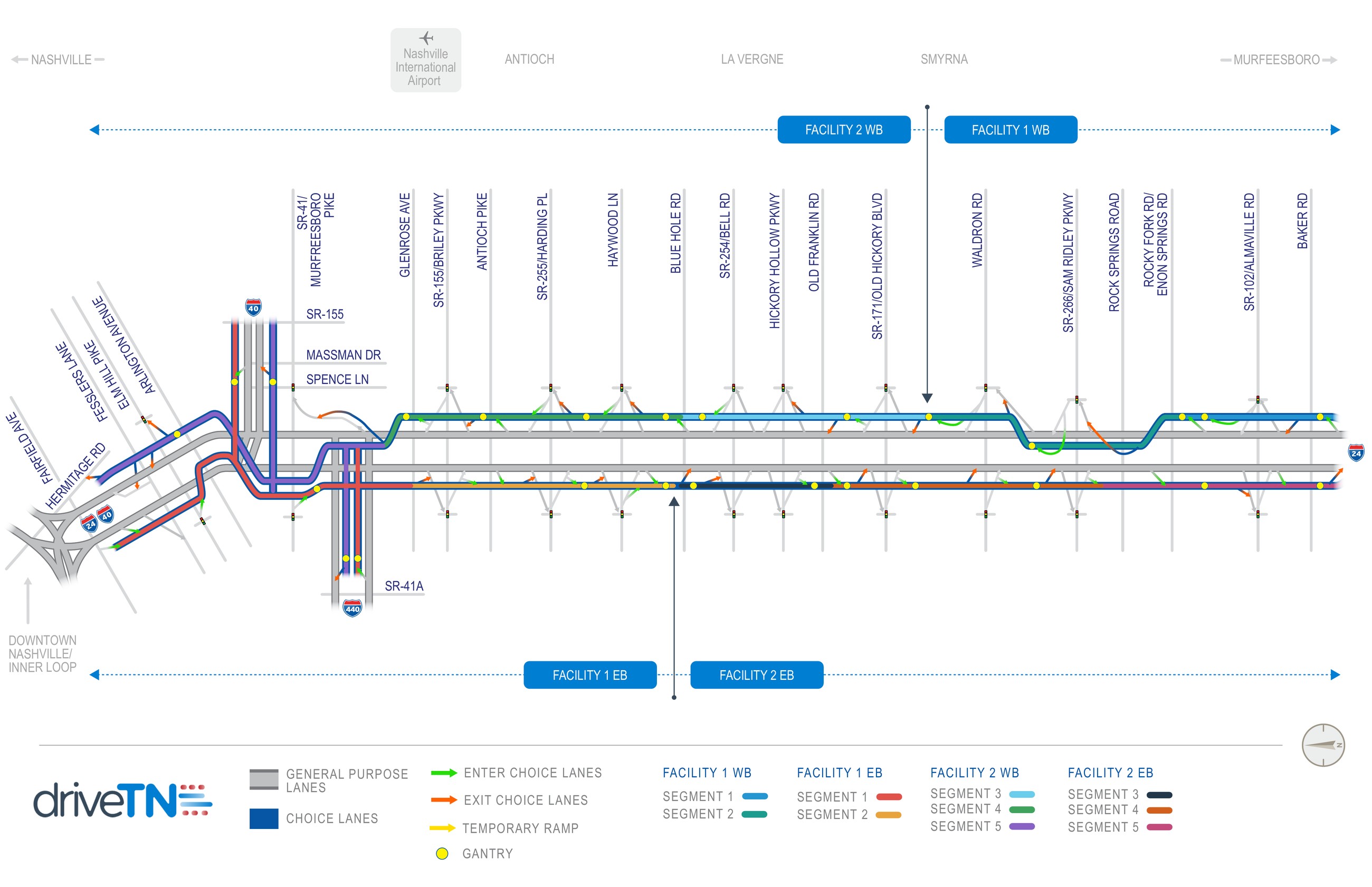
Filter by direction or type to browse all 4 user fee facilities and 10 user fee segments mapped across the corridor.
Explore the interactive corridor map or download the latest project materials.
⬇ Download Corridor MapDriveTN Corridor Program — presenting the I-24 Southeast Choice Lanes corridor as part of the Tennessee Choice Lanes proposal.
Contact the Project Team